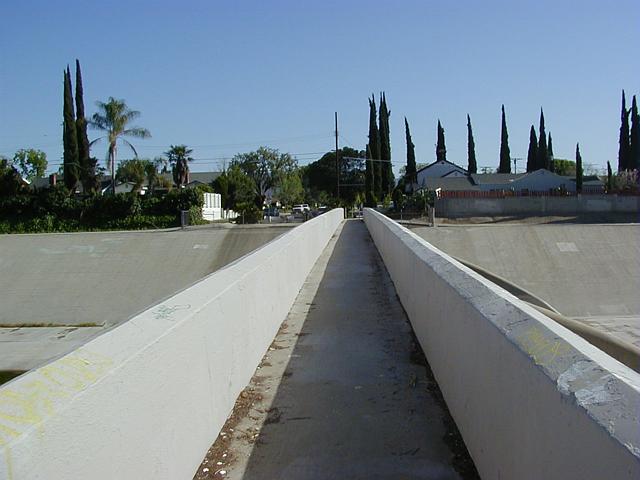
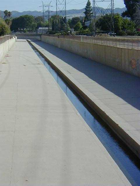
 1-09
1-09 Pedestrian Bridge over LAR downstream from Aliso merge.
Facing south, downstream is to the left. Note you can just see the tapered supports on upstream (right) side of the bridge.
1-09
Pedestrian Bridge over LAR downstream from Aliso merge.
Facing south, downstream is to the left. Note you can just
see the tapered supports on upstream (right) side of the bridge.
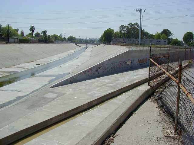 3-1
3-1
Closeup of Aliso terminating at the LAR.
It's like a geometry class for civil engineers.
That certainly looks like a cell phone tower in the background.
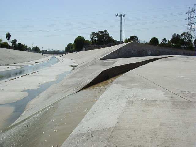 3-4
3-4
Closeup of Aliso slot terminating.
Note brown water; sediment is still clearing from the last big rain
a few days ago. Normally the water is clear.
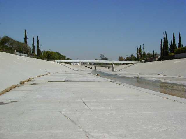 3-7
3-7
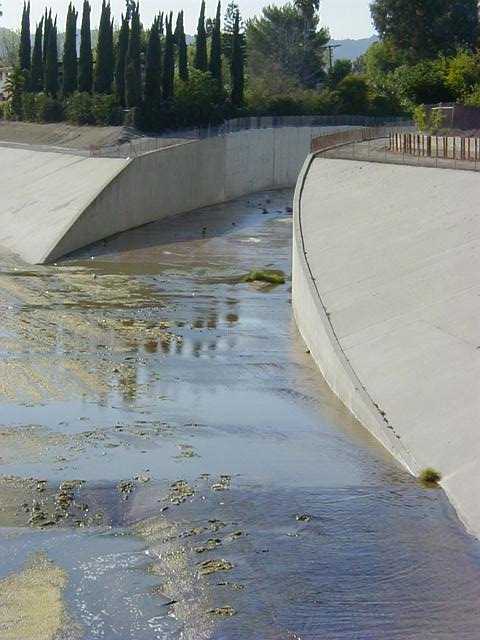
Pedestrian Bridge from river bed.
A warm FOVICKS moment; desolate solitude.
Taken 2 days after the flood on 04/15/00 (tax day 2000), the river is completely back to its normal dry flow. The only indication of flooding is the brown tinted water in the runoff from the Aliso. Days ago, this was covered in three or four feet of very turbulent water.
 1-10
1-10
Aliso Canyon Wash.
Near intersection of Crebs and Hart, just north of Vanowen.
Taken from a pedestrian bridge looking south, facing downstream where the wash begins to turn to join the LAR.
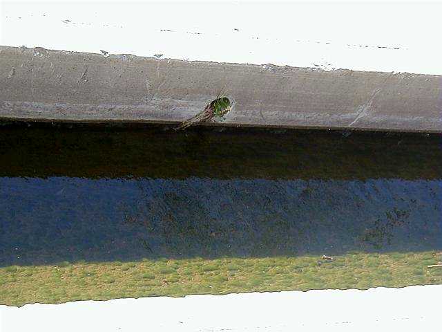 1-11
1-11
Closeup of the Aliso's slot. Ground water 'weep holes' with grass growing out of it.
These allow water build up behind the concrete a way to get out. Water marks along the
sides of the slot show the flow doesn't vary much; moss right up to the water level, and
there's no moss above the current water level, so this is its median flow throughout most
of the year.
 1-12
1-12
Warning Sign.
Typical of signs found along all the LA flood control rivers. Many sections of the river is fenced in from the public. Especially in sections where the walls are vertical and high, where a fall would probably be fatal. People are warned to stay out of the river bed, even though most of the year it is dry; the water can surge suddenly if an upstream debris basin is suddenly emptied, or if a dam vents some water to clear its gates.
Never the less, one can often find people riding their bikes in the river, or local kids exploring the walls and beds. My warning to anyone: keep an eye on the mountains upstream.. if you see a rainstorm out there, get outta the river! The waters might rise quickly, even though it's sunny where you're standing..!
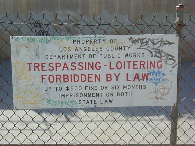
 1-13
1-13
The eastern entrance to the Hart street pedestrian
overpass. The dated design probably reveals its
construction, sometime in the 1940's or 1950's.
 1-14
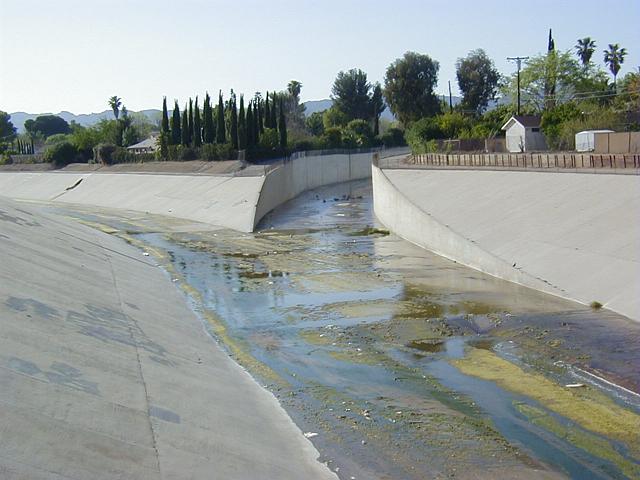
1-14
Brown's Canyon Wash / LA River Merging.
Near Mason and Vanowen, Canoga Park. The LAR's 'slot' stops and restarts where the two rivers join; for vehicle access I imagine, so a service truck can access either side of the 'slot'.
You can see from the mess how well the 'slot' prevents debris buildup and stagnation of the dry season water flow.
For some reason, the Browns Canyon Wash does not have a 'slot'. In some places, the LAR looses its slot for many miles too; not sure why. The river is often extremely stagnated in these 'slotless' sections, causing detremental odors to nearby residents.
The tributary's cross-section is precisely 'cleaved' by the LA River's wall. It looks like the engineers had fun building the walls to merge this way.
 1-15
1-15
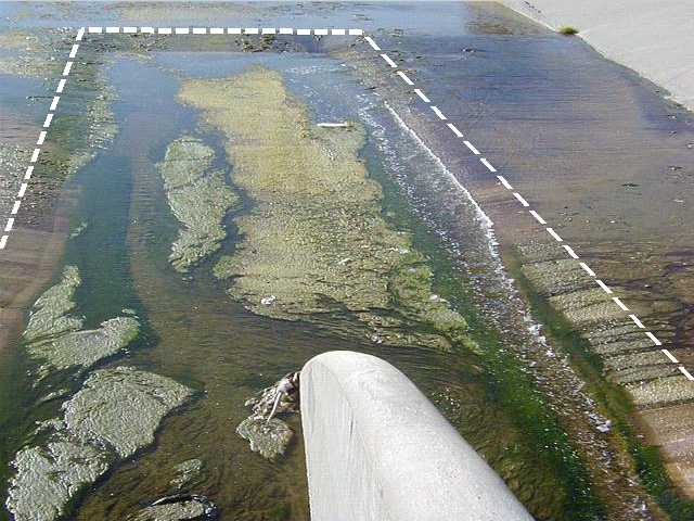
Restarting of the LAR 'slot'
Dotted line shows the beginning of the 'slot',
just downstream of the Browns Canyon Wash.
In this case, the bridge's support falls in the middle of the slot. The hairy moss is very abundant here, presumably because of the miles of stagnation north along the BCW.
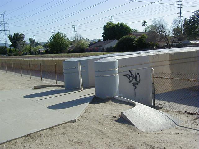
 1-16
1-16
Closeup of the Brown's Canyon merging walls.
Note LAR's slot begins again in lower left of frame,
again, to allow vehicles access to either side
of the slot.
| Next Page... |  |
|
Back to my home page. All images on this page © Copyright 2000 Greg Ercolano. All rights reserved. |